Monday, May 7, 2012

Singapore


From Gili Meno we took a boat back to Denpasar and then flew from there to Singapore. Getting off of the plane in Singapore provided us with another round of culture shock. We went from a country where just having a car was a luxury to a place where having anything but a luxury car was hard for people to accept. It is not totally surprising because Singapore has built its entire economy around buying and selling. Nothing is grown or produced in Singapore, but the country has still managed to become wealthy by acting as a middleman for a huge variety of goods that are shipped all around the world.


We spent our time in Singapore shopping, enjoying the incredible variety of food and checking out Sentosa Island. The number of shopping centers in Singapore is absolutely astounding and the number of Louis Vuitton stores was enough to boggle the mind. That was before we discovered and got lost in the six floors of electronics at Sim Lim Square.


To get a view of the whole city we went to the top of the Marina Bay Sands Hotel and marveled at the number of ships anchored in the harbor.


Sentosa Island is connected to Singapore by a walkway and cable car. It is covered in resorts and theme park attractions. It is not the type of place we usually visit, but since we were there we decided to go all out and buy a day pass. It let us experience most of the attractions on the island besides Universal Studios and we had a blast feeling like a couple of kids without parents to slow us down.


We felt incredibly safe in Singapore and enjoyed riding the amazingly clean and orderly subway system, but also felt like we always had to make sure we were following the strict rules. These include being careful about chewing gum (no gum is sold in Singapore), making sure we did not litter (even accidentally) and being careful to make sure that any public toilet we used was flushed cleanly (it’s a caning offense if you do not). It’s a strange dichotomy that was good to experience.

Gili Meno


From Darwin we flew to Denpasar on the island of Bali in Indonesia. After our time in New Zealand and Australia the taxi ride from Denpasar to Ubud was an assault on our senses. It was hard for our eyes to focus as our taxi weaved through the scooter traffic using the oncoming lane as well as our own. The constant honking of horns filled our ears while the smells of sewage and delicious cooking completed the sensory overload. We were so entranced that we did not say anything to each other until the taxi stopped moving. We had a delicious meal that was a nice change from the fare we had become accustomed to over the last year and spent the evening wandering the streets trying to get used to all the new sights and sounds. 


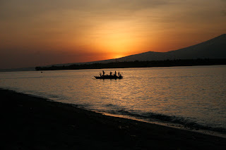
The next day we took a boat to a small, nearby island called Gili Meno. It is an island that barely rises above sea level and is a perfect place to enjoy some sun on the beach. Most of our time was spent snorkeling, reading, relaxing or eating. The island is small enough to walk around in under two hours and it does not take long for the locals to get to know you. From our beachside bungalow on the southeast corner of the island we had a great view of the sunrise and watched pods of dolphins swim by as we ate breakfast. Except for the occasional stomach problems that came along with eating the local food it fit our definition of an island paradise.


Cairns and Darwin


From Brisbane we continued a little further north to a stop on the Sunshine Coast. We enjoyed the relaxed atmosphere and incredible beaches there before continuing on. Our next stop was in Rockhampton. It is touted as the beef capital of Australia and has the rural, farming town feel to match. Another long day of driving through cane fields brought us to Townsville. It is a beautiful town with an incredible white sand beach, an active nightlife and a wonderful hill in the middle of town that provides beautiful vistas of the surrounding country. A final long day of driving through banana plantations brought us to Cairns. Townsville was definitely worth a visit but it is hard for us to recommend the drive. As one website we read said, “take a look at how long the drive from Brisbane to Cairns is and then buy an airline ticket.” 


Cairns is the stopping off point for most tourists who hope to see the Great Barrier Reef. We were no different and as soon as we got into town, tried to find a boat that would take us out to see it. Unfortunately for us it was the end of a long Easter weekend and the boats were already full. We were disappointed, but managed to have some fun by going to a BBQ where we met other travelers and tried emu, crocodile and kangaroo meat. Cairns does not have a beach for relaxing and swimming so they built a large pool called The Lagoon in a waterfront park so that people can enjoy swimming near the sea. We certainly learned a good lesson about checking holiday dates and making bookings in advance. 


We were ambitious enough to drive up the east coast, but driving to Darwin was way outside of our timeframe so we hopped on a plane. The first thing that we noticed when we landed was the incredible heat. Temperatures neared 40C with humidity over 80% and I started sweating almost immediately while Jenni glowed. The city of Darwin is pretty small without much going on in the CBD, but in the surrounding country there are some incredible national parks and an amazing variety of wildlife. We were hoping to visit Kakadu National Park but found out that the minimum time for a tour of the park was three days. We only had time to do a day tour of Litchfield National Park. The tour included a visit to see crocodiles on the Adelaide River, the magnetic termite mounds and some beautiful waterfalls.

Friday, April 6, 2012

Melbourne, Sydney and Brisbane


Those are not new cities in New Zealand so the title of our blog is a little off now. We flew from Auckland to Melbourne where we spent our first few nights in Australia. It was a bit of a shock to our systems going from a country with a population of 4.5 million to a city with about the same population. Thankfully Melbourne is a beautiful city that does not seem as large as it is. We had fun walking the streets, visiting the Queen Victoria Market and taking in an AFL game at the Melbourne Cricket Grounds. The Queen Victoria Market is a couple of city blocks that have been turned into stalls for selling everything from fruit and vegetables to leather purses and jackets. It was a wonderful place to experience and we spent a couple of mornings there buying fresh fruit, bread and cheeses for breakfast. The Australian Football League (AFL) plays a game that is a cross between rugby and soccer that is very similar to Gaelic Football played in Ireland. It was fun to watch a game and the crowd of around 80,000 was funny to listen to after they had a few beers.

We rented a car in Melbourne and drove to Sydney. Sydney’s urban area only has 500,000 more people than Melbourne’s but it feels like a much larger city. The people are not as friendly and the traffic is worse. There are some wonderful areas in Sydney including Darling Harbor (lots of food and drinks), The Rocks (the old part of town), the botanical garden and domain park and of course the Circular Quay with the Sidney Harbor Bridge on one side and the Sydney Opera House on the other. The other nice thing about Sydney is that you can take a ferry out of town to one of the beach communities quite easily. We spent a day in Manly watching the Australian beach volleyball championships and enjoying the golden sand.

The drive from Sydney to Brisbane was too long for us to do in one day so we stopped overnight in Coffs Harbour, a beautiful beach town. Brisbane seemed like a small town after being in Sydney. The most striking feature of Brisbane is the Brisbane River, which winds its way through the city and its suburbs. It keeps residents on their toes by flooding every few years and also acts as a highway for the water taxis and other boats that service the city. We enjoyed the farmer’s market and a cruise up the river to the Lone Pine Koala Sanctuary where Jenni got to cuddle a koala.


Friday, March 30, 2012

Goodbye New Zealand


After leaving the Golden Shears we drove as quickly as we could to Auckland and began preparing to sell our car. Just after pulling up to a cleaning station our car was backed into by a truck and our plan went out the window. It was not our fault, but our insurance had run out the day before so we had to deal with the situation directly. We spent our remaining time in Auckland walking Ponsonby Road and Queen Street, checking out the fancy boats in the harbor for the Volvo Ocean Race and visiting the Sky Tower to get a nighttime view of the city.

Thankfully the family we had stayed with at the start of our trip was willing to have us visit again so we headed out to their house. Being back there felt like being home with family and we quickly settled back in to farm life. They set us up with a repair shop for our car and we helped out around the farm. During the first couple of weeks the weather was rainy so we stayed around the house and took the children to Kelly Tarlton’s (an aquarium in Auckland). The last week was spent working on a new garage and getting our things packed.

After 19,000 kilometers of driving, multiple boat rides, around 1,000 kilometers of walking (including nine great walks), a couple of pairs of shoes and making some incredible friends it was sad to say goodbye to New Zealand. We are already planning our trip back.


Tuesday, March 6, 2012

Golden Shears

Golden Shears Final
Gavin Mutch, World Champ
South African blade shearers

We still have a few weeks left in New Zealand, but our last planned activity was the Golden Shears. The Golden Shears is a famous shearing competition and this year it was also where the shearing world championships were held. Over 2,000 people including the Prime Minister, John Key, showed up to cheer at the top of their lungs for the competitors. Highlights included John Key getting up on stage and pretending like he was going to shear and the award presentation for the machine shearing world championship when a group got up and did a Haka and then a Scotsman sang his national anthem in response. You can check out the videos of the shearing here: http://goldenshears.co.nz/live12.htm.


John Kirkpatrick, Golden Shears champ
Joel Henare, Woolhandling world champ
John Key at the Golden Shears

Sunday, March 4, 2012

Whanganui River Journey

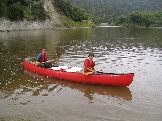
Our last “great walk” was spent sitting on our backsides, paddling down a river. It was certainly a nice change for us and we enjoyed not carrying a pack. The great walk section of the river from Taumarunui to Pipiriki takes five days, but there are also options for one, two, three and four day trips on that section of the river. The trip can also be extended right down to Wanganui by adding another two days from Pipiriki. There are a number of rental companies who will rent out Canadian Canoes or kayaks for use and provide transport to and from the river. We chose to do the 145km, five day paddle in a Canadian Canoe rented from Blazing Paddles because the canoe gave us plenty of room for food and drinks.

On our first day we paddled from Cherry Grove in Taumarunui to the Ohinepane Campsite. It was strange paddling on a brown river, but the surroundings were beautiful. We spent the second day journeying to the Mangapapa Campsite. We stopped for lunch in Whakahora where we had a coffee at the blue duck café. The Mangapapa Campsite was high on the bank of the river and provided us with an incredible view up the river valley.

 
The first two days we did not see any other people on the river or at the campsites, but the journey from Whakahora to Pipiriki is the most popular part of the trip so on our third night we finally had company. After a lovely day of paddling we decided to spend the evening at the Mangawaiti Campsite which is high on a rocky bluff above a narrow canyon. It was a steep hike up with our camping gear, but the spot was well worth the walk.


The highlight of the fourth day of our trip was the walk out to the Bridge to Nowhere. It is a beautiful concrete bridge that was finished in 1936 to service a few farms in the area, but shortly after that the government decided not to maintain the road to the bridge and all the farmers were asked to move out of the area. Local legend has it that somewhere between two and five cars drove across the bridge. Now it is the largest tourist attraction in the Whanganui National Park with tourists taking jet boats up the river and walking in just to get a look at it. After our stop there it was a short paddle down to the Tieke Kainga Marae where we stayed for the night. A marae is a Maori owned group of buildings that are most often used as a meeting place. The one we stayed in also has a DOC hut attached to it and is available for visitor use.

Our last day on the river took us through the three larges rapids that we experienced on the trip, Ngaporo, Autapu and Paparoa. Thankfully by this point in the journey we had gotten better at paddling together and managed to keep the canoe upright through all three.

After our journey was over we took a drive on the Forgotten World Highway. It took us through some of the most incredible farming country that we have seen. It was full of steep peaks and deep valleys with almost no visible access. We made a quick stop in the Republic of Whangamomona to get our passports stamped before continuing on to Mt. Taranaki.


Thursday, February 23, 2012

Northern Circuit


Our first activity once we got back to the north island was (surprise, surprise) another walk. The Northern Circuit is a walk around Mount Ngauruhoe (most recognizable for its role as Mount Doom in the Lord of the Rings) in Tongariro National Park which is located in the center of the north island. Tongariro National Park is known for being the home of the best day walk in New Zealand, the Tongariro Alpine Crossing. The Northern Circuit is the three or four day walk that includes this day walk.

We decided to take four days so that we could do more of the side trips that are available along the way. Our journey started in Whakapapa Village and took us to the east. The first deviation from the main trail was to check out the small but beautiful Taranaki Falls. From there we were able to stay on track until we reached the side trail to Tama Lakes. Lower Tama was an incredible turquoise color that sparkled in the sun while Upper Tama was a beautiful dark blue with Mount Ngauruhoe looming behind it. After having lunch near Lower Tama we continued east and were within five minutes of our destination for the evening when we were distracted by a trail on our right. Thankfully it was a very short trail. It took us to the oldest hut in Tongariro National Park, the original Waihohonu Hut, which was built in 1904. The most striking feature of the hut was its separate rooms for men and women. The men’s bunks were in the room with the fire place while the women’s room was accessed through the back of the hut and had a mirror for warmth. After seeing that we were a little concerned about what our lodging might be for the evening, but after rounding a couple of corners we came face to face with the new Waihohonu Hut, a hut that would rival any five star luxury accommodation lodge. It was completed in late 2010 and is by far the nicest hut we have seen in New Zealand. There was a large communal area with incredible picture windows, a massive deck, plenty of counter space, gas stoves, lights that could be turned on and off whenever we wanted and hot water for cooking. Before relaxing for the evening we went on one more side trip to the Ohinepango Springs to see the incredibly clear (and incredibly cold) water bubbling out of the ground.

We had gone to bed with almost clear skies but woke up to a blanket of low clouds. The first part of the day was spent walking through a beech forest so it was not until we emerged from the trees that we realized just how thick the clouds were. It was hard to see from one trail marker to the next and there were a few times that we had to stop and peer into the mist in search of the next marker. Around lunch time we made it to the Oturere Hut and decided to step inside to have our lunch. While we were eating the rain started falling so we extended our lunch to include a game of cards. Our timing was great as the sun came out just as we got back on the trail. We could finally see the landscape around us and it was stunning. There were strange rock formations all around us, a sprinkling of odd looking plants and the smell of sulfur was in the wind. It was easy to imagine that we had somehow been transported to another planet. After a steep climb we reached the part of the trail with the most spectacular views. We could see into the Central Crater, had beautiful views of the Emerald Lakes, peered into the Red Crater and looked across Blue Lake. It was an absolutely spectacular spot to stand. From there it was a short hike to the Ketetahi Hut where we watched the sun set and spent the night. The Ketetahi Hut is a little bit off the main circuit, but spending the night there meant that we would have two chances to see the views at the top.

In the morning the clouds were back and even thicker than before so we stayed in bed as long as we could and got a late start. We hiked the day walk trail in the opposite direction as the day walkers so we met hundreds of people as we walked along. The first few people that we met told us that they had not been able to see a thing and that the rain on the ridge was fierce, but by the time we made it there the clouds had broken up a bit and we got some nice views. Unfortunately the clouds were still hanging around the mountain peaks so we decided not to do the side trips to the Mount Tongariro or Mount Ngauruhoe summits. Not doing those walks meant that we easily could have completed the circuit in the afternoon but we stopped at the Mangatepopo Hut because we already had a booking. In the late afternoon the clouds cleared and we got to see the tops of Mount Tongariro and Mount Ngauruhoe.

The last day of hiking could easily have been skipped (and most people do). There is a carpark near Mangatepopo Hut so getting picked up there is easy, but since we had not arranged anything we had to walk back to Whakapapa Village. This section of the trail is called the ditch and on the day we walked it the name seemed appropriate. It was a narrow, deep trail so the rain ran right down the middle of it and the mud was very slippery. The vegetation was interesting, but there were not many views so we would not recommend walking that section unless you have to.

In Whakapapa Village we took some time to look around the visitor’s center and learned just how active the volcanic area we had walked through is. There are 15 places along the trail that have erupted sometime in the last 27,000 years (apparently not very long in geological terms). The most recent eruption of Mount Ngauruhoe was in 1975 and the volcanic alert level is currently at 1. Hiking through such recent volcanic activity is part of what makes the walk so spectacular, but it can give you pause if you take the time to think about it too much.


Saturday, February 18, 2012

The Horn Hilton and Molesworth


From Mt. Cook Village we drove back into Christchurch to meet with another family that my dad worked for 40 years ago during his time in New Zealand. They have sold most of the farm that my dad worked on but still own a few acres and one old house that were on the property. The house has undergone a bit of a remodel since my dad was there and it has been named the Horn Hilton. We spent a couple of nights at the Hilton making sure that the whisky bottles were clean and enjoying the quiet of the country. We also spent two nights in town listening to stories about my dad.

Our next stop was the thermal pools in Hanmer Springs. After a relaxing evening in the pools we decided to take the inland route north through Molesworth Station. Molesworth is the largest farm in New Zealand with a herd of around 10,000 cattle. It is owned by the New Zealand government and managed as both a farm and conservation area. The farm management is contracted out to a private company, Landcorp, while DOC manages the conservation. We drove through Molesworth on a grey, drizzly day but the views and historic cob houses were still incredible. We camped near the Molesworth homestead and then finished our drive back to paved roads the next day. If you have time it is a drive we would definitely recommend.

Wednesday, February 15, 2012

Mueller Hut


After finishing the Milford Track we drove to Mt. Cook Village and camped for a night. The next day we walked one kilometer vertically and a few kilometers horizontally to reach the Mueller Hut. The hut is used as a base by alpine climbers to explore the peaks in the area, but tourists also visit it to try to get the incredible views of Mt. Sefton and Mt. Cook that postcards are made of.

On the day we hiked up we got a brief glimpse of Mt. Cook’s peak before the clouds closed in. We got to see a little more of Mt. Sefton but the clouds kept the spectacular views out of sight. The Mueller Hut is at an elevation of 1810 meters and the peak of Mt. Olivier is only another 100 meters above it so we hiked up. Mt. Olivier is known for being the first peak that Sir Edmund Hillary climbed on his way to being the first person to summit Mt. Everest. We figure we will head for Mt. Everest next. Never mind that Sir Edmund Hillary was 20 when he climbed Mt. Olivier in the dead of winter with no trail, no hut and no shoes.

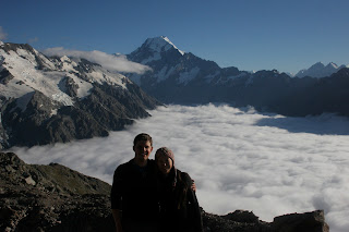
After spending the night in the Mueller Hut we woke up to a blanket of clouds in the valley below us and the sunlight casting a wonderful orange glow on the peaks of Mt. Sefton and Mt. Cook.


As the day warmed up we got to see a few ice falls. The sound of the ice falling creates a roar that fills the whole valley.
 
 It was hard to stop taking pictures even after we made it back down.