
 Our first activity once we got back to the north island was (surprise, surprise) another walk. The Northern Circuit is a walk around Mount Ngauruhoe (most recognizable for its role as Mount Doom in the Lord of the Rings) in Tongariro National Park which is located in the center of the north island. Tongariro National Park is known for being the home of the best day walk in New Zealand, the Tongariro Alpine Crossing. The Northern Circuit is the three or four day walk that includes this day walk.
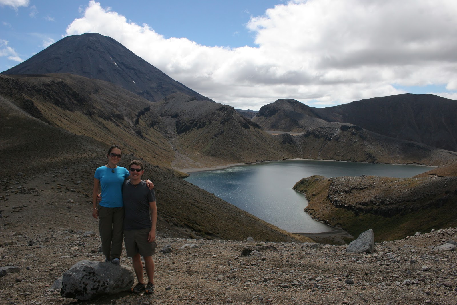 We decided to take four days so that we could do more of the side trips that are available along the way. Our journey started in Whakapapa Village and took us to the east. The first deviation from the main trail was to check out the small but beautiful Taranaki Falls. From there we were able to stay on track until we reached the side trail to Tama Lakes. Lower Tama was an incredible turquoise color that sparkled in the sun while Upper Tama was a beautiful dark blue with Mount Ngauruhoe looming behind it. After having lunch near Lower Tama we continued east and were within five minutes of our destination for the evening when we were distracted by a trail on our right. Thankfully it was a very short trail. It took us to the oldest hut in Tongariro National Park, the original Waihohonu Hut, which was built in 1904. The most striking feature of the hut was its separate rooms for men and women. The men’s bunks were in the room with the fire place while the women’s room was accessed through the back of the hut and had a mirror for warmth. After seeing that we were a little concerned about what our lodging might be for the evening, but after rounding a couple of corners we came face to face with the new Waihohonu Hut, a hut that would rival any five star luxury accommodation lodge. It was completed in late 2010 and is by far the nicest hut we have seen in New Zealand. There was a large communal area with incredible picture windows, a massive deck, plenty of counter space, gas stoves, lights that could be turned on and off whenever we wanted and hot water for cooking. Before relaxing for the evening we went on one more side trip to the Ohinepango Springs to see the incredibly clear (and incredibly cold) water bubbling out of the ground.
 We had gone to bed with almost clear skies but woke up to a blanket of low clouds. The first part of the day was spent walking through a beech forest so it was not until we emerged from the trees that we realized just how thick the clouds were. It was hard to see from one trail marker to the next and there were a few times that we had to stop and peer into the mist in search of the next marker. Around lunch time we made it to the Oturere Hut and decided to step inside to have our lunch. While we were eating the rain started falling so we extended our lunch to include a game of cards. Our timing was great as the sun came out just as we got back on the trail. We could finally see the landscape around us and it was stunning. There were strange rock formations all around us, a sprinkling of odd looking plants and the smell of sulfur was in the wind. It was easy to imagine that we had somehow been transported to another planet. After a steep climb we reached the part of the trail with the most spectacular views. We could see into the Central Crater, had beautiful views of the Emerald Lakes, peered into the Red Crater and looked across Blue Lake. It was an absolutely spectacular spot to stand. From there it was a short hike to the Ketetahi Hut where we watched the sun set and spent the night. The Ketetahi Hut is a little bit off the main circuit, but spending the night there meant that we would have two chances to see the views at the top.
In the morning the clouds were back and even thicker than before so we stayed in bed as long as we could and got a late start. We hiked the day walk trail in the opposite direction as the day walkers so we met hundreds of people as we walked along. The first few people that we met told us that they had not been able to see a thing and that the rain on the ridge was fierce, but by the time we made it there the clouds had broken up a bit and we got some nice views. Unfortunately the clouds were still hanging around the mountain peaks so we decided not to do the side trips to the Mount Tongariro or Mount Ngauruhoe summits. Not doing those walks meant that we easily could have completed the circuit in the afternoon but we stopped at the Mangatepopo Hut because we already had a booking. In the late afternoon the clouds cleared and we got to see the tops of Mount Tongariro and Mount Ngauruhoe.
The last day of hiking could easily have been skipped (and most people do). There is a carpark near Mangatepopo Hut so getting picked up there is easy, but since we had not arranged anything we had to walk back to Whakapapa Village. This section of the trail is called the ditch and on the day we walked it the name seemed appropriate. It was a narrow, deep trail so the rain ran right down the middle of it and the mud was very slippery. The vegetation was interesting, but there were not many views so we would not recommend walking that section unless you have to.
In Whakapapa Village we took some time to look around the visitor’s center and learned just how active the volcanic area we had walked through is. There are 15 places along the trail that have erupted sometime in the last 27,000 years (apparently not very long in geological terms). The most recent eruption of Mount Ngauruhoe was in 1975 and the volcanic alert level is currently at 1. Hiking through such recent volcanic activity is part of what makes the walk so spectacular, but it can give you pause if you take the time to think about it too much.

No comments:
Post a Comment