Routeburn Caples
 The Routeburn is one of the shorter great walks in New Zealand at just 32km. The hike is one of three great walks that need to be booked in advance (we booked it about a month before we wanted to do it because spaces were filling up). It is usually done in three days from one end to the other but can be combined with other walks to form a sort of loop. Since we had a car that we needed to get back to we decided to combine the Routeburn with the Caples Track to make the loop.
The night before starting the hike we stayed at a backpacker in Kinloch at the north end of Lake Wakatipu. The backpacker provided a shuttle to the Routeburn Shelter at the start of the trail. From there we walked up the Route Burn River. It was a wonderful, sunny day and the birds were out in full force so we were serenaded as we went. After about an hour of walking the trail headed away from the river and up into the Southern Alps. We reached the Routeburn Falls Hut in time for lunch and were rendered speechless by the views from its deck.
The weather forecast was for a change for the worse over night so we decided to take advantage of the sunshine by venturing up to the highest point on the trail. As we hiked up the trail the views got more and more spectacular. Our verbal skills are not good enough to explain what we saw and the pictures we took are only a poor caricature of the landscape. By the time we made it through Harris Saddle to the top of Conical Hill we knew that we were lucky to be experiencing one of the most incredible places in the world. We made it safely back to the Routeburn Falls Hut and took a refreshing dip in the river before celebrating Jenni’s 30th birthday.
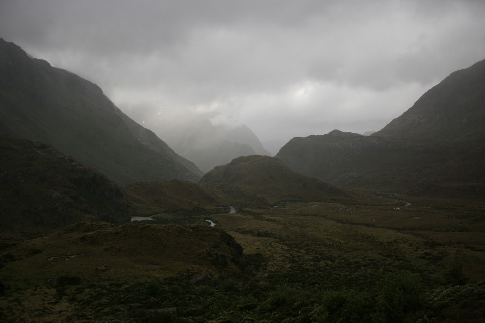
We woke up to rain falling on the roof of the hut and got on the trail as quickly as we could. The swirling clouds gave the valley a ghostly look. Gone were the impressive peaks of the day before but in their place were mountains shrouded in mystery. It rained on us until we reached Harris Saddle. At that point the sun broke through and a rainbow appeared out of the mist. It was an incredible sight and a good sign for the rest of our walk that day. From there on we did not experience a drop of rain and the wind at our backs dried us out. At times the wind gusted so strongly that we felt like a helping hand was pushing us along. It did not bother us, but we felt for the people who were walking in the other direction.
With the help of the wind we quickly reached the valley overlooking Lake MacKenzie and headed down the hill to the Lake MacKenzie Hut. Just before we reached the hut we passed through Fairy Glen, a forest that appears to have been tailored for a Lord of the Rings movie set. It is made up of gnarled beech trees with branches twisted in fantastic directions, moss covering all the right places and ferns that ensure everywhere you look is green. As we rushed into the hut, the sky opened up and rain began pouring down. We lit a fire to warm the place up and tried to sympathize with the soaking people who arrived behind us. Just before we had dinner the rain stopped and the sun came out. We got some incredible views up the valley behind the lake and across the Hollyford River into the Darran Mountains which Sir Edmund Hillary used as one of his practice areas before climbing Mt. Everest.
The rain stayed away for the day so we had a short, pleasant walk to the Lake Howden Hut on our third day. The highlight of the walk was the 174m Earland Falls. After a quick snack at Lake Howden we hiked up to Key Summit to try to get some views down the Hollyford Valley. Unfortunately the clouds did not cooperate so we did not get the postcard picture that we were hoping for. We had to settle for exploring the beautiful alpine vegetation on the summit before heading back down to the hut.
The next morning we left the Routeburn Track and headed for the Caples Valley. The track from Lake McKellar to McKellar Saddle was rerouted recently and is now a smooth, wide path. Our view from the pass was wonderful, but it was hard to fully appreciate it after the views we had seen on the Routeburn. The new trail from McKellar Saddle into the Caples Valley is still being worked on so we got to walk on the original trail which is very rocky and covered in tree roots. It was fun jumping from root to root as long as we stayed on our feet. We arrived at the Upper Caples Hut just in time to have lunch. The plan was to stay the night there, but the DOC hut warden who was also having lunch there told us that the Mid Caples Hut down the valley had a much nicer view with far fewer sandflies. The walk to the Mid Caples Hut took another two hours and was entirely worth the extra effort. We had a beautiful view back up the valley as we ate our dinner.
 Our extra walking on the fourth day meant that we could sleep in and still make it to our shuttle so we did. After breakfast and a short walk to explore the Caples River Gorge just below the hut we got on the trail. The hike out followed the Caples River until it met up with the Greenstone River and then followed that river to the parking lot where our shuttle picked us up.
It was nice to have a hot shower at the end of the day, but there was also some sadness at leaving such a beautiful area. It was an absolutely incredible walk and we were only rained on once which is pretty incredible for Fiordland. If you get a chance we would absolutely recommend the walk even if it is full of other tourists.

 The Routeburn is one of the shorter great walks in New Zealand at just 32km. The hike is one of three great walks that need to be booked in advance (we booked it about a month before we wanted to do it because spaces were filling up). It is usually done in three days from one end to the other but can be combined with other walks to form a sort of loop. Since we had a car that we needed to get back to we decided to combine the Routeburn with the Caples Track to make the loop.


 Our extra walking on the fourth day meant that we could sleep in and still make it to our shuttle so we did. After breakfast and a short walk to explore the Caples River Gorge just below the hut we got on the trail. The hike out followed the Caples River until it met up with the Greenstone River and then followed that river to the parking lot where our shuttle picked us up.

Hey guys
ReplyDeleteThanks for this nice information about a circuit walk opportunity. I have two questions:
Did you prebook the shuttle at the end of Caples track back to Kinloch or is that not necessary? And this means you could leave your car all the days at Kinloch until you returned?
Cheers
Tommy