Tuesday, January 17, 2012

Kepler Track


The Kepler Track is another of New Zealand’s Great Walks. It is one of three Great Walks in Fiordland and was built in the mid 80s to try to reduce the number of people hiking the other two main trails in the area. Unfortunately most people are like us and want to hike all three so the track did not do much to alleviate the number of walkers.

The Kepler Track is a loop walk that starts and ends at the control gates of Lake Te Anau just outside of the Te Anau township. The recommended way of walking the track is counterclockwise, but when we booked the track the only way available was clockwise. The walk is about 60 kilometers long, but parts of the track can be skipped if you take water taxis or get picked up by shuttles at alternative exits.

Our first day of hiking was in the rain from the control gates to the Moturau Hut. Most of the day was under the cover of beech forest so the rain got us wet, but not unpleasantly so. The walk follows the Waiau River for most of the day before heading past the Te Anau wetlands and to the shores of Lake Manapouri. The lakefront beach near the Moturau Hut had some incredible views of the sun setting over the mountains so we went to bed with that image in our head.

We woke up to pouring rain. It seemed that the drought that Fiordland had been experiencing for the last month was broken. Much of the hike was under the cover of beech forest, but about an hour before we reached the Iris Burn Hut we came out into a clearing that was the result of a large 1984 landslide. Whatever parts of us were still dry at that point got soaked so we felt (and probably looked) like a couple of drowned rats when we reached the hut. Fortunately the hut had a wood stove and some firewood so we lit the fire and got warmed up while eating our dinner.

On the third day of hiking we found out why clockwise is the suggested way to do the walk. Over our first two hours of hiking we gained 900 meters (2,950 feet) in elevation from 450 meters to 1,350 meters. The tree line ended at around 1,000 meters so from there on we were exposed to the wind and rain. While we were still on the side of the hill climbing it was not so bad, but once we reached to top of the ridge it felt like we could be blown away. Our raingear had seemed good at the start of the walk, but we soon found that it did not stand much of a chance against sideways rain. There were a few good views of the area before we got to the Hanging Valley Shelter but from there to the Luxmore Hut we did not get to see much but white stuff. Thankfully when we arrived at the Luxmore Hut the people who had come from the opposite way already had the fire going so we were able to quickly get out of our wet gear and warm up. The Luxmore Hut is above the tree line and in the afternoon there was a little bit of clearing so we got some terrific views.

The rain had seemed to let up over night and we could not hear any falling when we woke up. It was not until we looked out the window that we realized that precipitation had fallen all night in the form of snow. Even at 1,000 meters snow is quite unusual in January so it was a real treat to see the area covered in such a beautiful frosting. We felt for the people who had to do the alpine crossing in the snow as we headed down the hill to the relative warmth of the lakeside. It was an easy hike down and we shared it with a couple from Australia, which made it pass even more quickly. We were back at the control gates before we knew it and in the car on our way to Queenstown.
The reward at the end of the hike (Fergburger)

Thursday, January 12, 2012

Doubtful Sound


We spent about ten days making new friends in Northern Otago and Southland before journeying into Fiordland. Fiordland is in the southwest corner of the South Island and is often considered the most beautiful part of New Zealand. The area gets its name from the deep valleys carved by glaciers during the last ice age.

Doubtful Sound is one of the deepest fiords in New Zealand with a maximum depth of over 500 meters. To get to the sound we had to take a water taxi from Manapouri across Lake Manapouri to the West Arm power station (check that out on wikipedia if you like feats of engineering) and then a bus across Wilmot Pass to Deep Cove mooring. The views getting to Doubtful Sound were impressive, but they certainly had not prepared us for the incredible beauty of the sound.

The boat we were got on, Tutoko II, is operated by Fiordland Expeditions and has three crew members who service a maximum of twelve tourists on each overnight cruise. There were nine others on the trip with us and we quickly got to know them over lunch as we cruised through the sound. We checked a couple of cray pots on our way out to the Tasman Sea. The sea was a bit rough so we were not able to go out as far as the skipper had hoped. When we got back into the sound we found a spot to do some fishing to catch the rest our dinner. There were a number of small rock perch caught as well as a dog shark and a groper.

After catching enough for dinner the skipper took us to an anchorage near Blanket Bay. We went for a short paddle in kayaks before jumping in for a refreshing swim. Our dinner was incredible. It started with a curried squash soup followed by half a crayfish and then potatoes with rock perch and groper before finishing with a sticky pudding. By the time we went to bed the wind had died down and there was not even a hint of a wave on the sound.


It showered over night so in the morning we got to see Doubtful Sound blanked in low clouds. It is one of the few times that we have been disappointed that there was not more rain because the rain makes the sound even more beautiful. The small shower we experienced created a number of new waterfalls, but if there is real rain waterfalls cascade down the steep slopes throughout the sound. After breakfast the boat started heading back to Deep Cove.

Along the way we saw a pod of bottle nosed dolphins, were able to dip our heads in a waterfall from the front of the boat and went a short distance up one of the sound’s arms. It was sad when we finally docked and took the bus and water taxi back to Manapouri. We are already planning our next trip to Doubtful Sound, but we need ten other people to come along. Any volunteers?

Saturday, January 7, 2012

Stewart Island and the Rakiura Track


The ferry ride to Stewart Island is known for its rough seas, but on the day we crossed Foveaux Straight it was as calm as a lake. We fell in love with Stewart Island the moment we stepped off the boat. Any thoughts of moving quickly vanished with the morning fog and a feeling of complete relaxation enveloped us.

Stewart Island is 45km wide and 60km long and has about 27km of road. The roads are concentrated around the only town on the island, Oban, and the rest of the island is designated a reserve. As a result of the large reserve the bird life on the island is better than almost anywhere else in New Zealand.


We celebrated a quiet Christmas at a hostel with other travelers before starting our first adventure on Stewart Island, the Rakiura Track. It is the shortest of the New Zealand Great Walks and can be done in two or three days. We chose to do it in three days to maximize our chances of seeing a Kiwi. We started the hike from Oban and walked on roads for about 7km to the official start of the track. From there we hiked out to Port Williams Hut. The area surrounding this hut is supposed to be the best opportunity on the Rakiura Track to see a Kiwi so we wandered around outside until 11:30 trying in vain to catch a glimpse of the shy birds. Unfortunately we only saw a couple of possums.
 
The second day from the Port Williams Hut to the North Arm Hut was a short, easy walk through regrowth forest. We passed a couple of old steam powered log haulers and spotted a few Red Headed Parakeets and Kakas along the way. We decided not to stay up looking for Kiwis because of our failure the night before. Soon after falling asleep we were awakened by a Kiwi’s piercing call. At the time we were too sleepy to get up, but we certainly regretted that in the morning.

Our last day of hiking from the North Arm Hut back to Oban was also very short and most of it was on an old logging road that runs out to Kaipipi Point so we decided to make it longer by walking Ryan’s Trail at the end of the day. We were happy that we did because Ryan’s trail runs along the water and we got some nice views of the Inlet and saw a couple of Kaka along the way.

The next adventure we had was going out to Ulva Island. Ulva Island is a small island in the middle of Paterson Inlet that is one of the only open bird sanctuaries in the world. There has been an extensive trapping program on the island to rid it of nonnative animals (mice, possums, stoats and the like) and it is now home to some beautiful, rare birds. We took a ferry from Oban to the island and explored it for six hours. We soon found that some of the birds on the island were used to not having predators around and would quite happily approach us. Others were a little harder to spot, but we managed to see almost all of them except the Kiwi.

On New Year’s Eve we went on a six hour, guided kayak trip in Paterson Inlet. Our guide from Rakiura Kayaks took us along the coast out to an abandoned Norwegian whaling base. Along the way we saw a number of blue penguins and our guide picked up a few shellfish for us to eat with lunch. After the trip we walked out to Acker’s Point before returning to town for the New Year’s festivities.

The South Sea Hotel doubles as the island’s only pub and for New Year’s they light a big bonfire on the beach in front of the pub. It seemed like the whole island turned out for the celebration along with almost an equal number of tourists. There was a band playing from the balcony of the hotel and people were dancing in the street well into the night. At midnight there was a huge display of fireworks (actually flares). It was quite lovely to see the harbor illuminated with a red glow.

In the morning we bid a sad farewell to Stewart Island and climbed on the ferry to head back to the mainland. It was a rough ride back across the straight, but some of that could be because we were still recovering from the evening before.

Can you spot the bird?


Sunday, December 25, 2011

The Otago Coast and Catlins


We are starting to realize that our time in New Zealand is running out so over the last couple of weeks we have not been able to visit everything that we want to. Unfortunately this means that we focus on the highlights that our guidebook presents and miss many of the smaller things that locals have told us about. At least we know there will be plenty to do on our next trip.

Our last stop in Canterbury before we ventured into Otago was the Timaru beach and rose garden. The rose garden has an incredible variety of flowers and most of them were in full bloom when we stopped by. There is also a wonderful aviary in the park with some incredibly colored birds in it. From there we drove into Otago and stopped in Oamaru to watch the blue penguins come ashore in the evening and check out Oamaru’s Victorian style limestone buildings.

 
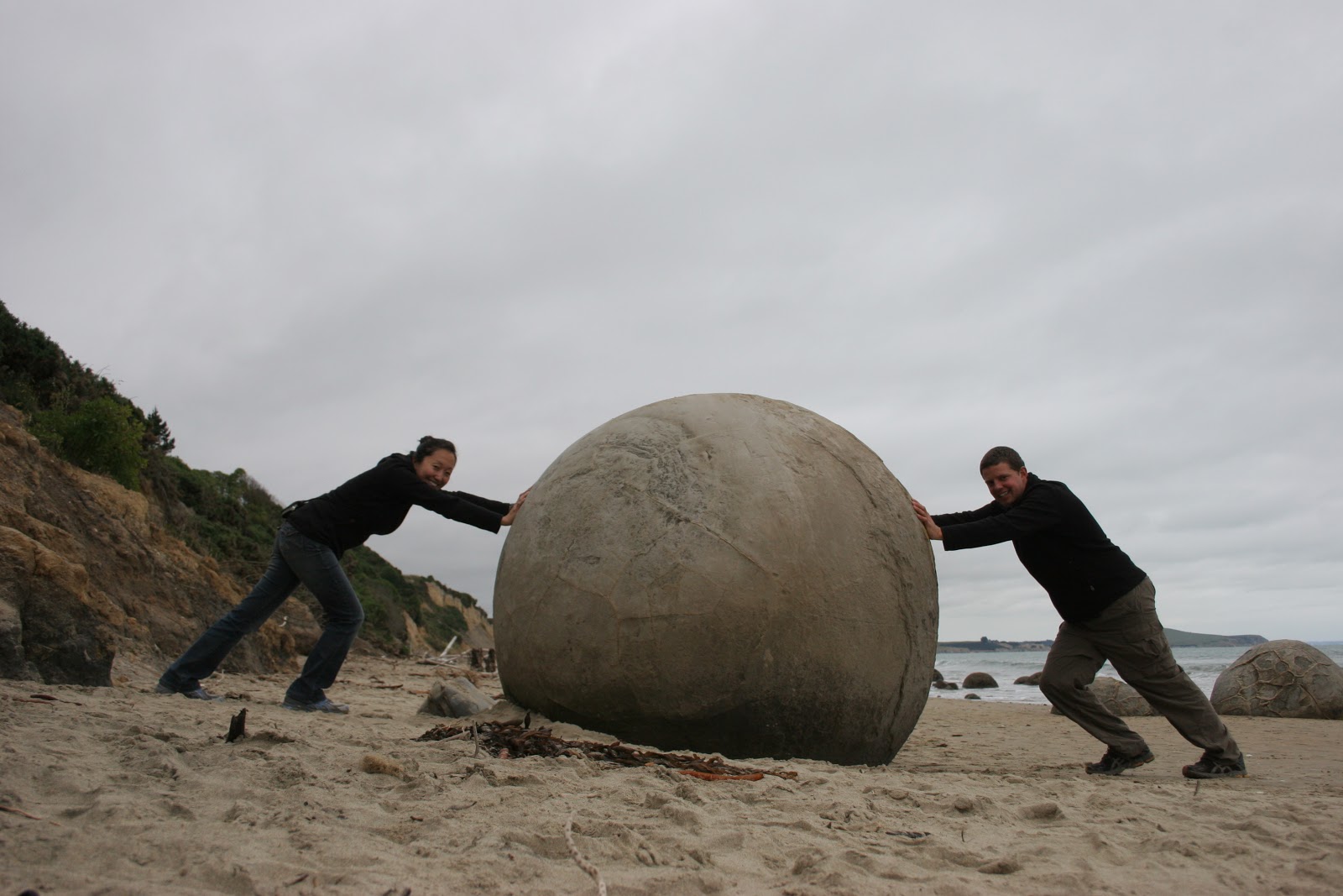
South of Oamaru we visited the Moeraki Boulders and sampled the fare at Fluer’s Place before stopping in Dunedin. Dunedin has some incredible bookshops and a few breweries so our time there was very enjoyable. The hills in Dunedin are also an attraction in their own right with Baldwin Street being named as the steepest street in the world. If Dunedin were at elevation it would surely produce some great runners.


From Dunedin we drove along the coast into the Catlins. The Catlins are known for being and incredibly windy place, but we had two days of sunny, calm weather. In that type of weather the beaches there are absolutely incredible. We stayed at the Curio Bay Campground which has two main attractions. The first is a section of 160 million year old petrified forest that has a few Yellow-Eyed Penguins nesting on it and the second is Porpoise Bay where Hector Dolphins come in the summer to have their babies. It was incredible to see such rare animals up close and we both feel lucky to have had the experience.

From the Catlins we drove straight to Invercargill to stay for a night before catching the ferry to Stewart Island where we are now.


Wherever you may be, Merry Christmas from Stewart Island!

Monday, December 19, 2011

Kaikoura, The Banks Peninsula and Christchurch

We left Golden Bay and the Nelson area just before the heavy rain, flooding and landslides started and headed down the east coast of the South Island into Canterbury. Our first stop along the coast was in Kaikoura, a town known for its wildlife. You can whale watch, swim with dolphins or seals, visit bird colonies and eat crayfish (kai means food and koura means crayfish). We decided to focus on the seals and did a couple of walks in the area that went near the seal colonies. The first walk we did was a little north of Kaikoura at Ohau Point. We walked up a stream to a small pool at the base of a waterfall where seal cows take their pups to be protected from the ocean storms. At the right time of year the pool is absolutely packed with pups (check it out on youtube), but when we where there one lone pup had the whole pool to itself. The other walk we did was the Kaikoura Peninsula Walk. This walk took us along the cliffs overlooking the ocean at the very tip of the peninsula. At one point on the walk we were able to venture down the cliffs to the rocky beach where birds were nesting and there was a small seal colony.

From Kaikoura we drove through Christchurch to Akaroa on the Banks Peninsula. Akaroa was originally settled by French colonists who had come over in hopes of staking France’s claim to New Zealand. The town plays up its French past to get tourists to come, but the only French things left are a few street names and a flag where the settlers landed. We were told by a couple of French friends staying in town that the croissants from the bakery were not even the French style. In spite of not being as French as advertised, it is a lovely town and we spent an enjoyable day walking around, checking out the art galleries and eating local fudge.

After a relaxing day in Akaroa we made our way back to Christchurch. Christchurch is very much a city on the mend after two devastating earthquakes and an unbelievable number of aftershocks. We wanted to do our part in helping out by spending some money in the city, but this turned out to be much harder than we had imagined. The damage to Christchurch’s CBD is quite visible and the area has been declared the red zone and fenced off. We were hoping to find relocated businesses that had been in the red zone and shops around the edge of the red zone that we could patronize, but there was no place to get good information about relocated or open shops. We googled each business to get new locations and hours and were sad to find that most had not yet reopened.

We walked around the outside of the red zone to get a sense of the damage. It was quite sobering to see the spray painted messages left on the front of buildings by the search and rescue teams. Peering in the windows of some of the buildings on the edge of cordon gave us a glimpse of the days the earthquakes happened. Personal items are visible and in restaurants you can still see plates on the tables and broken cups on the floors. On the weekend a path into the center of the red zone was opened so we went in and took a look at Cathedral Square. Most of the rubble has already been cleared away, but it was easy to get a sense of the destruction that had happened. For us the saddest part of walking around Christchurch was seeing all the empty houses near the CBD. Most of the houses had signs on them that they were safe for occupancy however they were completely empty. A few had for sale signs in front of them, but many of them looked totally abandoned.

Even with all the destruction and change going on around them the people of Christchurch were incredibly friendly and welcoming. In the southwest corner of the CBD a City Mall has been set up using shipping containers to house stores. It is beautifully done and the attitude there is incredibly positive. The farmer’s markets are also in full swing, the museum had some wonderful exhibits on display and the botanical gardens looked incredible, especially the rose garden. We are sure it will take some time, but we hope that Christchurch is able to rebuild and maintain its wonderful character.

Monday, December 12, 2011

The Mussel Inn Area


The Mussel Inn Area is known to most people as Golden Bay, but for us the Mussel Inn was so representative of the area that we stopped using its proper name. The Mussel Inn is a brewery-cafĂ© where business first, suit wearing, BMW driving people rub shoulders with vegan, dreadlocked, jalopy driving hippies. There is a pole covered in crucified cell phones and a sign that says, “Get the point?” The beer is brewed on site and the food is almost all caught or grown locally. The staff is friendly and their mood is contagious so if there is a bonfire burning or live music playing your are sure to make a new friend or two.

It is fitting that you have to cross Takaka Hill to reach Golden Bay because crossing the hill involves enough turns to make any San Francisco Street proud and makes you appreciate the effort that people go to live in the area.

Admittedly we did do more exploring in Golden Bay than just the Mussel Inn. We visited Farewell Spit, a 35km stretch of sand that includes some of the most important wetlands in the world. We intended to hike to Wharariki Beach to see its incredible rock formations and small seal colony and somehow overshot and ended up on Green Hill Beach. Finding our way from Green Hill Beach back to Wharariki Beach ended up being an off track adventure involving a few cliffs and a number of scratches on Jenni’s legs. We stayed at the Innlet and had an outdoor bath next to the creek before stopping at the Naked Possum for dessert. In Collingwood we bought chocolates from Rosy Glow Chocolate House where the chocolates are made not only with fresh ingredients right off the local farms, but also with love.

Takaka is the business center of Golden Bay, but that is a little like designating a rugby capital of the States. It is an arts and crafts town that does business because it has to. The incredible art galleries around town and relaxing atmosphere made us wish we were staying longer. We saw the clearest freshwater in the world at Te Waikoropupu Springs, visited the geological formations of The Grove and drove out to Tata Beach to find out why most people call the area Golden Bay.

We wanted to extend our time in Golden Bay to take up the rest of our trip, but the Nelson Saturday Market and other adventures dragged us back over Takaka Hill. If we ever come back to New Zealand we are going to make sure that our time in Golden Bay takes up a larger portion of the trip than it did this time.

If you get a chance make sure you try the Mussel Inn’s Happy Jackal Pumpkin Ale which tastes like pumpkin pie in a bottle.

Wednesday, December 7, 2011

The Heaphy and Karamea

As we headed north up the West Coast we kept an eye on the weather forecast to see if there was any chance that the rain might let up. When we got to Westport a window of good weather was being predicted so we decided to do the Heaphy track. The biggest challenge of the Heaphy track is getting from one end to the other before or after doing the hike. Driving takes over six hours and because of the taxi pickup times usually involves an overnight stay somewhere along the drive. Hitchhiking is possible but can take even longer because the ends of the track are in out of the way places. The quickest way from one end of the track to the other is flying, but it does cost a little more than the other options. The opening of good weather was not going to be long enough to drive so we decided to spoil ourselves and fly. We picked Jim, a Cessna pilot, to fly with because it was the cheapest option.

After making all the arrangements and picking up supplies in Westport, we drove up to Karamea to get packed and look around before our hike. Karamea has a number of interesting limestone formations nearby including arches over rivers and a variety of caves. We only had time to visit the arches over the Oparara River before getting organized for the hike.

In the morning we met Jim at the Karamea Aerodrome and took off for the northeast end of the track. Jim has been flying for quite a few years and knows the area quite well so he was able to show us some highlights of the track as we were flying over. We made a bouncy landing in a farmer’s field and were greeted by Jeff, Jim’s contact on the ground, who had a pipe hanging out of the corner of his mouth and drove us the five minutes past his place to the start of the Heaphy track grumbling the whole way about tourists and how busy it was becoming “out this way.” It was well worth the cost of the flight just to meet those two characters.

The shuttle bringing the masses to the beginning of the track arrives later in the day so we were alone on the start of the trail. The first day of the track is done through the forest, up a constant but gradual incline with very few views of the surrounding country. It may not sound that appealing, but we found the variety of bird and plant life along the way very entertaining. The few views that we did get along the way just whet our appetite for more and when we got to the Perry Saddle Hut, the views from their made the whole day worth it. It was a clear day so we decided to do the side trip from the Perry Saddle Hut up Mt. Perry. It is an unmaintained track which involves some scrambling over loose rock, but from the top (on a clear day) you can see Farewell Spit and Mt. Taranaki. There was a little too much haze for us to see Mt. Taranaki, but we did get our first look at Farewell Spit.

On the second day we walked from Perry Saddle through the Gouland and Mackay Downs to the James Mackay Hut. The downs are relatively flat areas covered in golden grass and shrubs. They look like they would be the perfect place for animals to graze, however when we stepped off the track and onto the swampy ground we quickly realized that it is no place for a farm. The Gouland Downs is the larger of the two and has a number of streams and rivers running through it which support an incredibly diverse ecosystem. On our way through the downs we saw the shells of giant snails, an incredibly large earthworm, a kea and a pair of blue ducks. The blue ducks were the highlight as they are an endangered species with a very limited habitat range.

Our third day of hiking involved descending from the James Mackay Hut to the Heaphy River and then along the river to the Heaphy Hut at its mouth. The journey down through the forest was similar to the first day although several of the tree species and birds that we saw were different. Our first encounter with the Heaphy River was crossing it on an 80 meter swing bridge. From there we walked along the river through the Nikau Palms, crossing several more swing bridges and stopping only briefly to eat lunch and be eaten by sandflies before reaching the Tasman Sea and the Heaphy Hut. The sun was shining through the palm trees onto the golden sand of the beach and the ocean was a sparkling blue. It looked down right tropical so we jumped in the river and were quickly reminded that a river mouth on the West Coast of the South Island is far from it. There was a beautiful sunset and as long as we avoided the water it was possible to imagine that we were in a tropical paradise.

Our last day was spent walking through the palm trees in the sun. The rocky beaches and waves that crashed with incredible ferocity were the only reminders that we were not in Hawaii. It was easy going and our shortest day of hiking, but it also felt like the most spectacular. We felt a sense of accomplishment tinged with sadness when we reached the parking lot at the end of the trail and caught the shuttle back to Karamea. That was quickly overwhelmed with sleepiness when we found a bed to fall into.

The next day we took a tour of the Honeycomb Hill caves just north of Karamea. They have restricted access because there are over 71km of caves that are full of Moa bones and incredible limestone formations that should not be touched. Our guide was a biologist who has been around the world working on different projects and he was full of wonderful information about the cave and its surrounding area. The only disappointment was that all of the Hast Eagle bones and most of the impressive Moa bones have been removed from the cave and taken to museums for study. After the tour we drove through the Buller Gorge to Nelson for a few days of rest.